Tidal Analysis & Predictions
Tidal analysis and predictions can be provided through the harmonic analysis of data captured over a period of thirty or more days.
There are many needs for water level information, with the most frequent use being for navigation. Many large vessels, including tankers, cargo ships and passenger ferries, plan their departure from or arrival at a port to coincide with the time of high water, and thus critically depend on tide predictions.
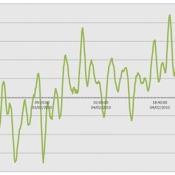
There are various causes of changes in water level and currents, but for most coastal and marine inland waterways the astronomical tide is usually the dominant cause. The analysis involves taking a series of sea level measurements made at regular intervals and resolving the amplitude and phase values for each constituent tide that comprises the observed tide at that place.
Data capture can be achieved by means of a tide gauge installed on a pier or quayside, or via a seabed mounted ADCP system. The analysis of sea level data for a single month will produce parameters for about 36 constituent tides.
Once the amplitude and phase values for a set of constituent tides have been calculated, this information can then analysed to create a tide curve for a specified time interval with the information used to find the times and heights of High Water and Low Water.
Predictions can be made for future and past dates, however accuracy will decrease as the time difference between the measurements used in the analysis and the prediction period increases.
Meteorological conditions can also have an effect on tidal patterns, therefore when conditions differ over those under which the data was collected actual tide times and heights may be different to those predicted.


